
Aug 18, 2026 · by BalayHub Admin · 6 min read
West Valley Fault Property Check: Is Your House Near It?
West Valley Fault property check: the cities it crosses, the 5 meter no build rule, PHIVOLCS FaultFinder and HazardHunterPH, and what the result means.
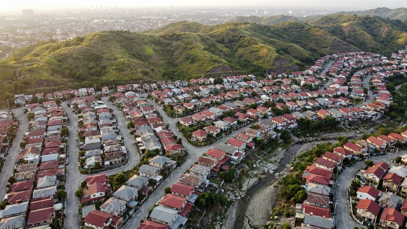
A West Valley Fault property check is the one piece of due diligence that Metro Manila buyers most often skip and most often regret, because the fault does not run through some distant province. It runs through Quezon City, Marikina, Pasig, Makati, Taguig, Parañaque and Muntinlupa, under subdivisions with familiar names, and the difference between a house on the trace and a house two streets away is the difference between a property PHIVOLCS says should not be there and one that simply needs to be well built. This guide explains what the fault is, how to check a specific address in a few minutes with free government tools, and what to do with the answer.
What the West Valley Fault is
The West Valley Fault is the active fault that runs roughly north to south along the eastern side of Metro Manila for about a hundred kilometers, from southern Bulacan through Rodriguez and San Mateo in Rizal, then through eastern Quezon City, Marikina, Pasig, Taguig and Muntinlupa, and on into San Pedro, Biñan, Santa Rosa, Cabuyao and Calamba in Laguna and the Carmona and Silang side of Cavite. PHIVOLCS, the Philippine Institute of Volcanology and Seismology, mapped its trace in detail in the Valley Fault System Atlas released in 2015 and updated since, and the scenario planners call its next major movement "the Big One", a magnitude 7.2 earthquake. When the atlas was published the Inquirer reported dozens of subdivisions and villages crossed by the trace, and Quezon City alone marked the fault through Bagong Silangan, Batasan Hills, Pansol, Blue Ridge, White Plains, Green Meadows, Bagumbayan and Ugong Norte.
Two facts matter for a buyer. The fault trace is a line, not a zone: the hazard that no engineering can fix, ground rupture, only affects structures sitting on or immediately beside it. And the shaking from a large earthquake affects the whole metro, with the intensity set more by the soil under a building than by its distance from the fault. Our earthquake risk guide for property buyers covers the second part; this article is about the first.
The 5 meter rule
PHIVOLCS advises that no structure should stand on top of an active fault or within 5 meters of it on either side, and Quezon City's local government adopted the same figure as a buffer zone that should be free of any structure, identifying hundreds of property owners inside it when it surveyed the trace. Five meters is the width of a narrow street. A house whose wall sits inside that band is a house that the science says cannot be made safe against rupture, whatever the contractor promises.
Outside the 5 meter band the question changes from "should this house exist" to "was it built to code, and on what soil". The National Structural Code sets the design standard for the whole seismic zone, and a well built house at 50 meters from the fault will ride out the same earthquake far better than a poorly built one at 500 meters. That is why the check has two steps, distance first and construction second.
How to check an address, step by step
Start with the PHIVOLCS FaultFinder, the institute's free web tool. Search the address, or drop a pin on the map at the property's coordinates, and it returns the distance and direction to the nearest known active fault trace. Anything under 5 meters is a hard no; anything under a few dozen meters deserves a site visit with the atlas in hand, because the mapped trace has its own margin of error and the property line may sit closer than the pin.
Then run the same coordinates through HazardHunterPH, the multi hazard tool run by GeoRisk Philippines under PHIVOLCS, which assesses ground rupture, ground shaking, liquefaction, landslide, flood and volcanic hazards for a pinned location and produces a report you can save. The liquefaction rating is the one to read carefully: it flags the soft, water saturated soils along the Marikina River, the Pasig and the reclaimed bay areas where shaking is amplified and foundations sink, and it applies to condos as much as to houses.
For the block level detail, open the Valley Fault System Atlas on the PHIVOLCS site, find the sheet for the city and locate the barangay; the atlas shows the trace against streets and subdivision boundaries. Cross check with the barangay hall, which in the cities crossed by the fault usually knows exactly which streets are on it, and with the city planning office, which can tell you whether a locational clearance was issued for the lot.
Buying from abroad changes nothing here. FaultFinder and HazardHunterPH work from anywhere, and a relative or a trusted representative can carry the atlas to the site. Our guide on how to check if a property floods uses the same tools for the other hazard that shows up on the same report.
What the result means for houses and for condos
For a house and lot, a trace within 5 meters ends the conversation. Between 5 and roughly 100 meters, ask for the structural plans and the building permit, look for a reinforced concrete frame rather than unreinforced hollow block walls carrying the roof, and get an engineer's inspection before you pay. The same distance band in a subdivision often shows in the price; a discount that looks generous usually has a reason on the atlas.
For a condo, the building either sits on the trace or it does not, and the developers of the last two decades have had the atlas to design around. What you are checking is the soil and the design: ask for the building's structural design basis, whether it has been inspected since the last significant earthquake, and what the association's earthquake plan is. Height matters less than people think, and our comparison of high rise and mid rise condos explains why a well founded tower behaves differently from a low rise on soft ground. Add the fault question to the turnover inspection checklist if you are buying pre selling.
Where this changes what you buy
The cities the fault crosses are also some of the metro's best places to live, and most of their housing is nowhere near the trace. The practical effect of the check is not to avoid Quezon City or Taguig; it is to compare two listings honestly. A house in Marikina on the river plain has a liquefaction question, a house in the Quezon City hills near Batasan has a distance question, and a condo in Taguig has a design question. Run the check, read the two reports, and let the answer decide between them rather than the price alone. For the Quezon City districts and their ground, our Quezon City neighborhoods guide notes which areas sit near the eastern hills the fault follows.
This article is general guidance. Fault traces, buffer rules and hazard ratings are published by PHIVOLCS and local governments and can be updated; check the current FaultFinder and HazardHunterPH results for the exact coordinates, and have a licensed structural engineer inspect any property before you buy.
Frequently asked questions
How do I check if my property is near the West Valley Fault?
Open the PHIVOLCS FaultFinder, search the address or drop a pin on the map, and read the distance to the nearest active fault trace. Then run the same coordinates on HazardHunterPH for the ground rupture, shaking and liquefaction ratings, and check the Valley Fault System Atlas sheet for the city to see the trace against streets. The barangay hall and the city planning office can confirm which lots sit on it.
How far from the West Valley Fault is safe?
PHIVOLCS advises that no structure should stand on the fault or within 5 meters of it on either side, and Quezon City adopted that 5 meter buffer as a no build zone. Beyond that band, ground rupture is no longer the issue; what matters is construction quality and soil. A house built to the structural code on firm ground at 50 meters is safer than a poorly built one at 500 meters.
Which cities does the West Valley Fault pass through?
From southern Bulacan through Rodriguez and San Mateo in Rizal, then eastern Quezon City, Marikina, Pasig, Makati, Taguig, Parañaque and Muntinlupa, and on to San Pedro, Biñan, Santa Rosa, Cabuyao and Calamba in Laguna and the Carmona and Silang side of Cavite, about a hundred kilometers in all. In Quezon City the marked areas include Bagong Silangan, Batasan Hills, Pansol, Blue Ridge, White Plains, Green Meadows, Bagumbayan and Ugong Norte.
Is a condo safer than a house near the fault?
Neither is safe on the trace itself. Away from it, a modern tower designed to the structural code on firm ground generally performs better than an older house of unreinforced hollow block, but a tower on soft, liquefiable soil has its own problem. Ask the developer for the structural design basis and check the liquefaction rating on HazardHunterPH before comparing the two on price.
Ang West Valley Fault property check ang isang bahagi ng due diligence na pinakamadalas laktawan ng mga buyer sa Metro Manila at pinakamadalas pagsisihan, dahil hindi sa malayong probinsya dumadaan ang fault. Dumadaan ito sa Quezon City, Marikina, Pasig, Makati, Taguig, Parañaque at Muntinlupa, sa ilalim ng mga subdivision na pamilyar ang pangalan, at ang pagkakaiba ng bahay na nasa mismong trace at ng bahay na dalawang kalye ang layo ay ang pagkakaiba ng property na sinasabi ng PHIVOLCS na hindi dapat naroon at ng property na kailangan lang maitayo nang maayos. Ipinapaliwanag ng gabay na ito kung ano ang fault, kung paano suriin ang partikular na address sa loob ng ilang minuto gamit ang mga libreng tool ng gobyerno, at kung ano ang gagawin sa sagot.
Ano ang West Valley Fault
Ang West Valley Fault ang active fault na dumadaan nang halos hilaga patungong timog sa silangang bahagi ng Metro Manila sa haba na mga isang daang kilometro, mula sa timog ng Bulacan patungong Rodriguez at San Mateo sa Rizal, pagkatapos sa silangang Quezon City, Marikina, Pasig, Taguig at Muntinlupa, at patuloy sa San Pedro, Biñan, Santa Rosa, Cabuyao at Calamba sa Laguna at sa panig ng Carmona at Silang sa Cavite. Detalyadong minapa ng PHIVOLCS, ang Philippine Institute of Volcanology and Seismology, ang trace nito sa Valley Fault System Atlas na inilabas noong 2015 at ina-update mula noon, at tinatawag ng mga scenario planner ang susunod na malaking paggalaw nito na "the Big One", isang magnitude 7.2 na lindol. Nang mailathala ang atlas, iniulat ng Inquirer ang dose-dosenang subdivision at village na tinatawid ng trace, at sa Quezon City pa lang, minarkahan ang fault sa Bagong Silangan, Batasan Hills, Pansol, Blue Ridge, White Plains, Green Meadows, Bagumbayan at Ugong Norte.
Dalawang bagay ang mahalaga para sa buyer. Linya ang fault trace, hindi zone: ang panganib na walang engineering na makakaayos, ang ground rupture, ay nakakaapekto lang sa mga istrukturang nakaupo sa mismong trace o katabi nito. At ang pagyanig mula sa malaking lindol ay nakakaapekto sa buong metro, at ang intensity ay mas nakadepende sa lupa sa ilalim ng gusali kaysa sa layo nito sa fault. Sinasaklaw ng aming gabay sa earthquake risk para sa mga property buyer ang pangalawang bahagi; ang artikulong ito ay tungkol sa una.
Ang 5 meter rule
Pinapayo ng PHIVOLCS na walang istrukturang dapat nakatayo sa ibabaw ng active fault o sa loob ng 5 meters mula rito sa magkabilang gilid, at ginamit ng lokal na pamahalaan ng Quezon City ang parehong sukat bilang buffer zone na dapat walang anumang istruktura, at natukoy nito ang daan-daang may-ari ng property sa loob nito nang i-survey ang trace. Ang limang metro ay lapad ng isang makipot na kalye. Ang bahay na ang pader ay nasa loob ng bandang iyon ay bahay na ayon sa siyensya ay hindi maaaring gawing ligtas laban sa rupture, anuman ang ipangako ng contractor.
Sa labas ng 5 meter band, nagbabago ang tanong mula sa "dapat bang umiral ang bahay na ito" patungo sa "naitayo ba ito ayon sa code, at sa anong lupa". Itinatakda ng National Structural Code ang design standard para sa buong seismic zone, at ang maayos na naitayong bahay na 50 meters mula sa fault ay mas makakayanan ang parehong lindol kaysa sa mahinang pagkakatayong bahay na 500 meters ang layo. Kaya dalawang hakbang ang check, distansya muna at konstruksyon pangalawa.
Paano suriin ang isang address, hakbang hakbang
Magsimula sa PHIVOLCS FaultFinder, ang libreng web tool ng institute. Hanapin ang address, o mag-drop ng pin sa mapa sa coordinates ng property, at ibabalik nito ang distansya at direksyon patungo sa pinakamalapit na kilalang active fault trace. Ang anumang mas mababa sa 5 meters ay tiyak na hindi; ang anumang mas mababa sa ilang dosenang metro ay nararapat na bisitahin sa site na may dalang atlas, dahil may sariling margin of error ang minapang trace at maaaring mas malapit ang property line kaysa sa pin.
Pagkatapos, ipasa ang parehong coordinates sa HazardHunterPH, ang multi hazard tool na pinapatakbo ng GeoRisk Philippines sa ilalim ng PHIVOLCS, na sumusuri sa ground rupture, ground shaking, liquefaction, landslide, baha at volcanic hazard para sa pinned na lokasyon at gumagawa ng report na puwede mong i-save. Ang liquefaction rating ang dapat basahin nang mabuti: tinutukoy nito ang malambot at puno ng tubig na lupa sa kahabaan ng Marikina River, ng Pasig at ng mga reclaimed na bahagi ng bay kung saan lumalakas ang pagyanig at lumulubog ang pundasyon, at nalalapat ito sa mga condo gaya ng sa mga bahay.
Para sa detalye sa antas ng block, buksan ang Valley Fault System Atlas sa site ng PHIVOLCS, hanapin ang sheet para sa lungsod at hanapin ang barangay; ipinapakita ng atlas ang trace kasabay ng mga kalye at hangganan ng subdivision. I-cross check sa barangay hall, na sa mga lungsod na tinatawid ng fault ay kadalasang alam na alam kung aling mga kalye ang nasa ibabaw nito, at sa city planning office, na makakapagsabi kung may inilabas na locational clearance para sa lote.
Walang nagbabago rito kung bumibili ka mula sa ibang bansa. Gumagana ang FaultFinder at HazardHunterPH kahit saan, at maaaring dalhin ng kamag-anak o pinagkakatiwalaang kinatawan ang atlas sa site. Ginagamit ng aming gabay sa kung paano malalaman kung binabaha ang property ang parehong mga tool para sa isa pang panganib na lumalabas sa parehong report.
Ano ang ibig sabihin ng resulta para sa mga bahay at mga condo
Para sa house and lot, tapos na ang usapan kapag may trace sa loob ng 5 meters. Sa pagitan ng 5 at humigit-kumulang 100 meters, hingin ang structural plans at ang building permit, hanapin ang reinforced concrete frame sa halip na unreinforced hollow block na pader na bumubuhat sa bubong, at magpa-inspect sa engineer bago ka magbayad. Ang parehong distance band sa loob ng subdivision ay madalas makita sa presyo; ang discount na mukhang malaki ay kadalasang may dahilan sa atlas.
Para sa condo, nakaupo ang gusali sa trace o hindi, at ang mga developer sa nakalipas na dalawang dekada ay may atlas nang gamitin sa disenyo. Ang sinusuri mo ay ang lupa at ang disenyo: hingin ang structural design basis ng gusali, kung na-inspect ba ito mula noong huling malakas na lindol, at kung ano ang earthquake plan ng association. Hindi kasinghalaga ng iniisip ng mga tao ang taas, at ipinapaliwanag ng aming paghahambing ng high rise at mid rise na condo kung bakit iba ang kilos ng tower na may matibay na pundasyon kaysa sa low rise sa malambot na lupa. Idagdag ang tanong tungkol sa fault sa turnover inspection checklist kung bumibili ka nang pre selling.
Kung saan nito binabago ang bibilhin mo
Ang mga lungsod na tinatawid ng fault ay kabilang din sa pinakamagagandang lugar na tirahan sa metro, at karamihan sa mga bahay doon ay malayo sa trace. Ang praktikal na epekto ng check ay hindi ang iwasan ang Quezon City o Taguig; ito ay ang tapat na paghahambing ng dalawang listing. Ang bahay sa Marikina sa river plain ay may tanong tungkol sa liquefaction, ang bahay sa kaburulan ng Quezon City malapit sa Batasan ay may tanong tungkol sa distansya, at ang condo sa Taguig ay may tanong tungkol sa disenyo. Patakbuhin ang check, basahin ang dalawang report, at hayaang ang sagot ang magpasya sa pagitan ng dalawa sa halip na presyo lang. Para sa mga distrito ng Quezon City at sa lupa ng mga ito, binabanggit ng aming gabay sa mga neighborhood ng Quezon City kung aling mga lugar ang malapit sa silangang kaburulang sinusundan ng fault.
Pangkalahatang gabay ang artikulong ito. Ang mga fault trace, buffer rule at hazard rating ay inilalathala ng PHIVOLCS at ng mga lokal na pamahalaan at maaaring ma-update; suriin ang kasalukuyang resulta ng FaultFinder at HazardHunterPH para sa eksaktong coordinates, at magpa-inspect sa lisensyadong structural engineer ng anumang property bago ka bumili.
Mga madalas itanong
Paano ko malalaman kung malapit sa West Valley Fault ang property ko?
Buksan ang PHIVOLCS FaultFinder, hanapin ang address o mag-drop ng pin sa mapa, at basahin ang distansya patungo sa pinakamalapit na active fault trace. Pagkatapos, ipasa ang parehong coordinates sa HazardHunterPH para sa rating ng ground rupture, shaking at liquefaction, at tingnan ang sheet ng Valley Fault System Atlas para sa lungsod para makita ang trace kasabay ng mga kalye. Makakapagkumpirma ang barangay hall at ang city planning office kung aling mga lote ang nasa ibabaw nito.
Gaano kalayo mula sa West Valley Fault ang ligtas?
Pinapayo ng PHIVOLCS na walang istrukturang dapat nakatayo sa fault o sa loob ng 5 meters mula rito sa magkabilang gilid, at ginamit ng Quezon City ang 5 meter buffer na iyon bilang no build zone. Sa labas ng bandang iyon, hindi na ground rupture ang isyu; ang mahalaga ay ang kalidad ng konstruksyon at ang lupa. Ang bahay na naitayo ayon sa structural code sa matigas na lupa sa 50 meters ay mas ligtas kaysa sa mahinang pagkakatayong bahay sa 500 meters.
Aling mga lungsod ang dinadaanan ng West Valley Fault?
Mula sa timog ng Bulacan patungong Rodriguez at San Mateo sa Rizal, pagkatapos sa silangang Quezon City, Marikina, Pasig, Makati, Taguig, Parañaque at Muntinlupa, at patuloy sa San Pedro, Biñan, Santa Rosa, Cabuyao at Calamba sa Laguna at sa panig ng Carmona at Silang sa Cavite, mga isang daang kilometro lahat-lahat. Sa Quezon City, kabilang sa mga minarkahang lugar ang Bagong Silangan, Batasan Hills, Pansol, Blue Ridge, White Plains, Green Meadows, Bagumbayan at Ugong Norte.
Mas ligtas ba ang condo kaysa sa bahay malapit sa fault?
Walang ligtas sa dalawa kapag nasa mismong trace. Kapag malayo rito, ang modernong tower na dinisenyo ayon sa structural code sa matigas na lupa ay karaniwang mas mahusay kaysa sa lumang bahay na unreinforced hollow block, pero ang tower sa malambot at liquefiable na lupa ay may sariling problema. Hingin sa developer ang structural design basis at tingnan ang liquefaction rating sa HazardHunterPH bago ikumpara ang dalawa sa presyo.
Ang West Valley Fault property check mao ang usa ka due diligence nga kanunay laktawan sa mga buyer sa Metro Manila ug kanunay usab nilang pagbasulan, kay ang fault wala moagi sa layong probinsya. Moagi kini sa Quezon City, Marikina, Pasig, Makati, Taguig, Parañaque ug Muntinlupa, ubos sa mga subdivision nga pamilyar ang ngalan, ug ang kalainan sa balay nga naa sa trace ug sa balay nga duha ka dalan ang gilay-on mao ang kalainan sa property nga giingon sa PHIVOLCS nga dili unta didto ug sa usa nga kinahanglan lang nga maayo ang pagkatukod. Kini nga giya nagpasabot kon unsa ang fault, unsaon pag-check sa usa ka espesipikong address sa pipila ka minuto gamit ang libre nga mga himan sa gobyerno, ug unsa ang buhaton sa tubag.
Unsa ang West Valley Fault
Ang West Valley Fault mao ang active fault nga moagi gikan sa amihanan paingon sa habagatan sa sidlakang bahin sa Metro Manila sa gilay-on nga mga 100 kilometers, gikan sa habagatang Bulacan agi sa Rodriguez ug San Mateo sa Rizal, dayon sa sidlakang Quezon City, Marikina, Pasig, Taguig ug Muntinlupa, ug padayon sa San Pedro, Biñan, Santa Rosa, Cabuyao ug Calamba sa Laguna ug sa Carmona ug Silang nga bahin sa Cavite. Ang PHIVOLCS, ang Philippine Institute of Volcanology and Seismology, nag-mapa sa trace niini sa detalye sa Valley Fault System Atlas nga gipagawas sa 2015 ug gi-update sukad niadto, ug gitawag sa mga scenario planner ang sunod nga dakong paglihok niini nga "the Big One", usa ka magnitude 7.2 nga linog. Sa dihang gipagawas ang atlas, ang Inquirer nag-report og daghang subdivision ug village nga giagian sa trace, ug ang Quezon City lang nagmarka sa fault agi sa Bagong Silangan, Batasan Hills, Pansol, Blue Ridge, White Plains, Green Meadows, Bagumbayan ug Ugong Norte.
Duha ka kamatuoran ang importante sa buyer. Ang fault trace usa ka linya, dili zone: ang peligro nga walay engineering nga makaayo, ang ground rupture, moapekto lang sa mga istruktura nga naa mismo sa ibabaw o tupad gyud niini. Ug ang pag-uyog gikan sa dakong linog moapekto sa tibuok metro, ug ang kakusog gitakda mas sa yuta ilalom sa building kaysa sa gilay-on niini gikan sa fault. Ang among giya sa earthquake risk para sa mga property buyer naghisgot sa ikaduhang bahin; kini nga artikulo bahin sa una.
Ang 5 meter rule
Nagtambag ang PHIVOLCS nga walay istruktura nga angay motindog sa ibabaw sa active fault o sulod sa 5 meters gikan niini sa bisan asang kilid, ug gisagop sa lokal nga gobyerno sa Quezon City ang samang numero isip buffer zone nga kinahanglan walay bisan unsang istruktura, ug nakaila kini og gatosan ka tag-iya sa property sulod niini sa dihang gi-survey ang trace. Ang 5 meters mao ang gilapdon sa usa ka sikip nga dalan. Ang balay nga ang paril naa sulod niana nga banda mao ang balay nga giingon sa siyensya nga dili mahimong luwas batok sa rupture, bisan unsa pa ang isaad sa contractor.
Gawas sa 5 meter nga banda, mausab ang pangutana gikan sa "angay ba nga naa kini nga balay" ngadto sa "gitukod ba kini sumala sa code, ug sa unsang yuta". Ang National Structural Code nagtakda sa design standard para sa tibuok seismic zone, ug ang maayong pagkatukod nga balay sa 50 meters gikan sa fault mas makasugakod sa samang linog kaysa sa dili maayong pagkatukod nga balay sa 500 meters. Mao nga duha ka lakang ang check, distansya una ug konstruksyon ikaduha.
Unsaon pag-check sa usa ka address, step by step
Sugdi sa PHIVOLCS FaultFinder, ang libre nga web tool sa institute. I-search ang address, o i-drop ang pin sa mapa sa coordinates sa property, ug ipakita niini ang distansya ug direksyon paingon sa pinakaduol nga nailhan nga active fault trace. Ang bisan unsa nga ubos sa 5 meters usa ka hugot nga dili; ang bisan unsa nga ubos sa pipila ka dosena ka metro angay bisitahon sa site nga dala ang atlas, kay ang na-mapa nga trace adunay kaugalingong margin of error ug ang property line mahimong mas duol kaysa pin.
Dayon ipaagi ang samang coordinates sa HazardHunterPH, ang multi hazard tool nga gipadagan sa GeoRisk Philippines ubos sa PHIVOLCS, nga nag-assess sa ground rupture, ground shaking, liquefaction, landslide, baha ug volcanic hazard para sa gi-pin nga lokasyon ug naghimo og report nga imong ma-save. Ang liquefaction rating mao ang basahon og maayo: gi-flag niini ang humok ug basa nga yuta ubay sa Marikina River, sa Pasig ug sa mga reclaimed nga bahin sa bay diin mas kusog ang pag-uyog ug molubong ang mga foundation, ug magamit kini sa mga condo sama sa mga balay.
Para sa detalye sa matag block, ablihi ang Valley Fault System Atlas sa PHIVOLCS site, pangitaa ang sheet para sa siyudad ug pangitaa ang barangay; gipakita sa atlas ang trace batok sa mga dalan ug utlanan sa subdivision. I-cross check sa barangay hall, nga sa mga siyudad nga giagian sa fault kasagaran nahibalo gyud kon unsang mga dalan ang naa niini, ug sa city planning office, nga makasulti nimo kon na-isyu ba ang locational clearance para sa lot.
Ang pagpalit gikan sa abroad walay kausaban dinhi. Ang FaultFinder ug HazardHunterPH magamit bisan asa, ug ang paryente o kasaligang representante makadala sa atlas ngadto sa site. Ang among giya sa unsaon pag-check kon mabahaan ang property naggamit sa samang mga himan para sa laing peligro nga makita sa samang report.
Unsa ang pasabot sa resulta para sa mga balay ug sa mga condo
Para sa house and lot, ang trace sulod sa 5 meters mao na ang kataposan sa istorya. Tali sa 5 ug mga 100 meters, pangayoa ang structural plans ug ang building permit, pangitaa ang reinforced concrete frame imbes sa unreinforced nga hollow block nga paril nga nagsuporta sa atop, ug pakuhaa og inspeksyon sa engineer sa dili pa ka mobayad. Ang samang distansya sa usa ka subdivision kasagaran makita sa presyo; ang discount nga morag dako kasagaran adunay rason sa atlas.
Para sa condo, ang building naa sa trace o wala, ug ang mga developer sa miaging duha ka dekada aduna nay atlas nga masandigan sa pag-design. Ang imong gi-check mao ang yuta ug ang design: pangayoa ang structural design basis sa building, kon na-inspect ba kini sukad sa kataposang dakong linog, ug unsa ang earthquake plan sa association. Ang kataas dili kaayo importante kaysa gihunahuna sa mga tawo, ug ang among pagtandi sa high rise ug mid rise nga condo nagpasabot ngano nga lahi ang paglihok sa tower nga maayo ang foundation kaysa low rise sa humok nga yuta. Idugang ang pangutana bahin sa fault sa turnover inspection checklist kon mopalit ka og pre selling.
Asa kini makausab sa imong paliton
Ang mga siyudad nga giagian sa fault usa usab sa pinakamaayong puy-anan sa metro, ug kadaghanan sa ilang mga balay layo kaayo sa trace. Ang praktikal nga epekto sa check dili ang paglikay sa Quezon City o Taguig; kondili ang pagtandi sa duha ka listing nga matinud-anon. Ang balay sa Marikina sa patag sa suba adunay pangutana sa liquefaction, ang balay sa mga bungtod sa Quezon City duol sa Batasan adunay pangutana sa distansya, ug ang condo sa Taguig adunay pangutana sa design. Buhata ang check, basaha ang duha ka report, ug pasagdi nga ang tubag ang mopili tali kanila imbes ang presyo lang. Para sa mga distrito sa Quezon City ug sa ilang yuta, ang among giya sa mga neighborhood sa Quezon City nagtimaan kon unsang mga lugar ang duol sa sidlakang mga bungtod nga giagian sa fault.
Kini nga artikulo kinatibuk-ang giya. Ang mga fault trace, buffer rule ug hazard rating gipagawas sa PHIVOLCS ug sa mga lokal nga gobyerno ug mahimong ma-update; susiha ang kasamtangang resulta sa FaultFinder ug HazardHunterPH para sa eksaktong coordinates, ug pa-inspect sa lisensyadong structural engineer ang bisan unsang property sa dili pa ka mopalit.
Mga kasagarang pangutana
Unsaon nako pag-check kon duol ang akong property sa West Valley Fault?
Ablihi ang PHIVOLCS FaultFinder, i-search ang address o i-drop ang pin sa mapa, ug basaha ang distansya paingon sa pinakaduol nga active fault trace. Dayon ipaagi ang samang coordinates sa HazardHunterPH para sa ground rupture, shaking ug liquefaction rating, ug tan-awa ang sheet sa Valley Fault System Atlas para sa siyudad aron makita ang trace batok sa mga dalan. Ang barangay hall ug ang city planning office makakumpirma kon unsang mga lot ang naa niini.
Unsa ka layo gikan sa West Valley Fault ang luwas?
Nagtambag ang PHIVOLCS nga walay istruktura nga angay motindog sa fault o sulod sa 5 meters gikan niini sa bisan asang kilid, ug gisagop sa Quezon City kana nga 5 meter buffer isip no build zone. Gawas niana nga banda, dili na ground rupture ang isyu; ang importante mao ang kalidad sa konstruksyon ug ang yuta. Ang balay nga gitukod sumala sa structural code sa lig-on nga yuta sa 50 meters mas luwas kaysa dili maayong pagkatukod nga balay sa 500 meters.
Unsang mga siyudad ang giagian sa West Valley Fault?
Gikan sa habagatang Bulacan agi sa Rodriguez ug San Mateo sa Rizal, dayon sa sidlakang Quezon City, Marikina, Pasig, Makati, Taguig, Parañaque ug Muntinlupa, ug padayon sa San Pedro, Biñan, Santa Rosa, Cabuyao ug Calamba sa Laguna ug sa Carmona ug Silang nga bahin sa Cavite, mga 100 kilometers tanan. Sa Quezon City ang mga gimarkahang lugar naglakip sa Bagong Silangan, Batasan Hills, Pansol, Blue Ridge, White Plains, Green Meadows, Bagumbayan ug Ugong Norte.
Mas luwas ba ang condo kaysa balay duol sa fault?
Walay luwas sa duha kon naa mismo sa trace. Layo niini, ang modernong tower nga gi-design sumala sa structural code sa lig-on nga yuta kasagaran mas maayo ang performance kaysa daan nga balay nga unreinforced hollow block, apan ang tower sa humok ug liquefiable nga yuta adunay kaugalingong problema. Pangayoa sa developer ang structural design basis ug tan-awa ang liquefaction rating sa HazardHunterPH sa dili pa itandi ang duha sa presyo.
Looking for a place?
See all listings →Read next
High-Rise vs Mid-Rise Condo in the Philippines: Which to Buy
High rise vs mid rise condo in the Philippines: the 15 meter Fire Code line, why dues climb with height, quake and flood behavior, and who each suits.
Rent Increase Philippines 2026: the 1% Cap and Your Rights
Rent increase Philippines 2026: the 1% cap on units at ₱10,000 or less, what the contract governs above that, deposit limits, ejectment and penalties.
Verify DHSUD License to Sell Before You Pay: 2026 Guide
How to verify a DHSUD License to Sell in ten minutes: PD 957 Sections 4, 5 and 39, the tower by tower check, the documents to demand, and the red flags.